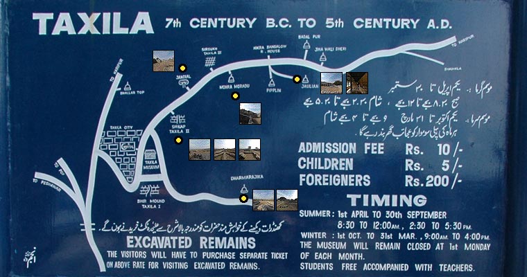
Taxila
The City of Stones
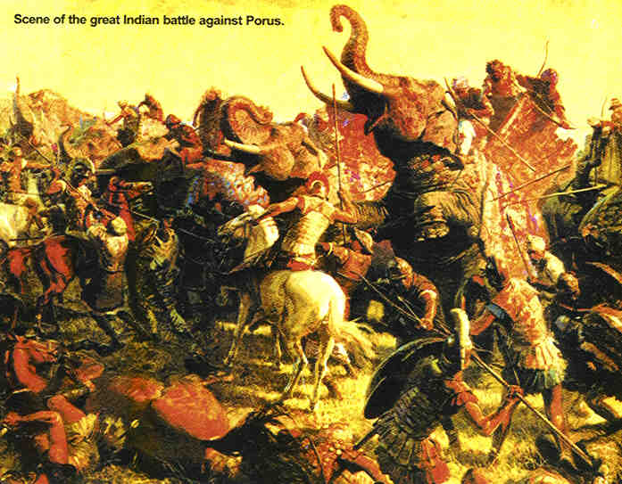
Moving northwards from Harappa and Moenjodaro, come remains of another city that thrived between 518 BC to 600 AD. Around the present day Taxila and a little over 20 miles north of Islamabad, lie the remains of the an ancient city whose actual name varies from scripture to scripture and from one language to another. "Tashasila" as it was called in Sanskrit gives some idea of the meaning of this name. Sila in Sanskrit means rock or stone . The legend says that the Buddha gave his head in charity to a man at this place . The Chinese called it "Chu-cha-shi-lo". The difficulty of Chinese phonetics with the sila and sira has led to this day to have names around Taxila such as Sirkap, Sirsukh and Margalla. Whatever its actual name. it was the most flourishing of all the cities between the Indus and Jhelum Rivers. Darius I formed it part of Achaemenid Empire of Persia. In 326 BC Alexander the Great and his armies encountered the charging elephants at battle against Hindu king Porus.
Before fighting the battle he and his armies marched through the city of Taxila and were greeted by King Ambhi. The Greeks lauded the city as the "greatest of all the cities" in the area. Alexander annexed the area as part of his enormous kingdom, but his weak successors were unable to hold on to the prize. In 300 BC Taxila was conquered by the Mauryan Empire under Chandragupta. As the Mauryan empire disintegrated the Bactrian Greeks, the successors of Alexander, conquered the area in 190 B.C. Their king moved the city to a new location - Sirkap - which they believed would be more defensible. The new city was built with a fortified acropolis and a large defensive wall of coursed rubble.
The Bactrian kings kept a foothold on the area till about 90 BC, when the Scythians overran the area and occupied the city. 150 years later, the Kushans, originally from China's Gansu province, invaded Ghandara (the name of the region around Taxila) and established a dynasty. The Kushan kings ruled well, supporting both the arts and Buddhism. Trade flourished with the Roman Empire, which led to almost unimaginable wealth. This era is justly described as Taxila's golden age. The downfall of the Kushan kings came in 230 AD, when the Sassanian Emperor Shahpur annexed it as part of his Empire. The Sassanian rule as very short, and power soon passed to the Kidara Kushana, an offshoot of the dispossessed Kushan rulers. They established a strong dynasty that endured till the second half of the 5th century. Though not as magnificent as the Kushan rulers of the past, the Kidara Kushana founded many Buddhist monasteries and reinvigorated Taxila with wealth and magnificence. Taxila's downfall came in the 5th century AD when the White Hun hordes ransacked the area, destroying monasteries and looting city's treasures. When the famous Chinese pilgrim monk Hsuan Tsang visited the area in the 7th century (while looking for Buddhist Sutras), he described it by saying "monasteries are half ruined. The country is depopulated and now a dependency of Kashmir."
Ashoka (or Asoka), the Indian king, ruled here as Governor under his father Bindusara. After the bloody conquest of Kalinga, which claimed hundreds of thousands of lives, Ashoka converted to Buddhism and as emperor, constructed a large number of Buddhist monuments and monasteries throughout the empire, including some at Taxila. Dharmarajika Stupa is a particularly good example, where he enshrined relics of the historical Buddha.
Taxila lie at the meeting place of three great trade routes; one from India, which was to become the "royal highway" described by Megasthenes as running from Patliputra (modern Patna city) to the north-west of the Maurya Empire; the second from Western Asia through Bactria, Kapisi, and Pushkalavati or Purushapura (modern Peshawar) and so across the Indus at Ohind (near Attock) to Taxila; and the third from Kashmir and Central Asia by way of the Srinagar valley. These three trade-routes, which carried the bulk of the traffic passing by land between India and Central and Western Asia, played an all-important part in the history of Taxila, for it was mainly to them that the city owed its initial existence as well as its subsequent prosperity and greatness. The fourth trade route was of course the Indus river near Taxila from where access to the Arabian or Indian Ocean was about a 1000 miles down stream via the cities of Multan and Thatta, great cotton & textile centers as the old remains of Mohenjo-Daro and the Indus valley civilization have proven.
Taxila is said to be a teaching place or a modern day university, where students could study any subject, "religious or secular, from the Vedas to mathematics and medicine, even to astrology and archery". The prominence of Taxila as a seat of academic and practical teaching was a result of the city’s geographical location and its reputation as an institute that promoted exchange and discussion of both western and eastern ideas. The city abounds in Gandhara architecture and a semblance of Greek imprints. It is just a coincidence that Islamabad was designed by a Greek Architect /Town Planner called "Doxiades " who also used a lot of the Gandhara architectural style in constructing the new Institution at Islamabad notably the Islamabad University.
Bhir Mound
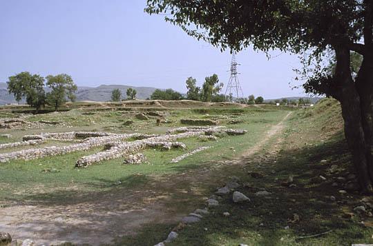
The remains of Taxila are spread over a large area, and have been distributed into various sections keeping in view their style of architecture and usage. To the south west of the site is the Bhir Mound, the remains of a thriving city that flourished from the 6th to the 2nd centuries BC. Built on a small plateau in the open fields, the city took advantage of the various trade routes crisscrossing central Asia. Though fortified, the city was no match for Alexander the Great, who conquered the area in the 3rd century B.C. It was here that King Ambhi received Alexander and his Greek armies. Little survives of the city beyond foundation stones, but these tell us that the streets were narrow and the house plans very irregular. There is little evidence of planning - most of the streets are very haphazard. The houses were probably made of stone rubble with wooden ceilings. Settlement at the Bhir mound site ended when the Bactrian Greeks built a new city called Sirkap (also archived on this website).
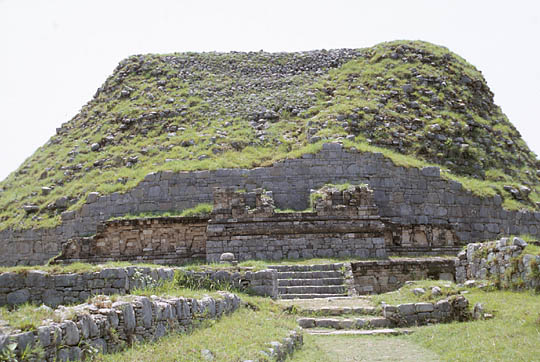
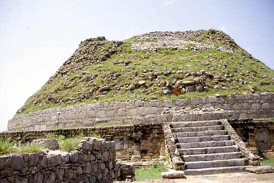
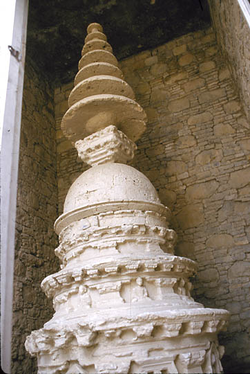
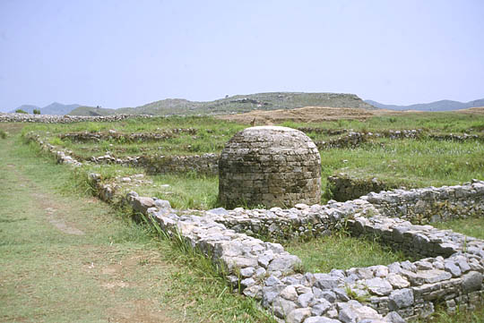
Dharmarajika Stupa (2nd century AD) The earliest Buddhist monument in Pakistan
Dharmarajika Stupa is one of eight shrines constructed in the 3rd century BC during the reign of Emperor Ashoka of the Mauryan dynasty to house relics of the Buddha. The shrine gradually expanded, reaching its largest size in the 2nd century A.D. Now a ruin, the stupa was once coated with lime plaster and gilding, though these have fallen away along with a seven-tier umbrella stone that once crowned the top. Near the stupa are the remains of vast monasteries that are barely distinguishable but for the foundation stones.
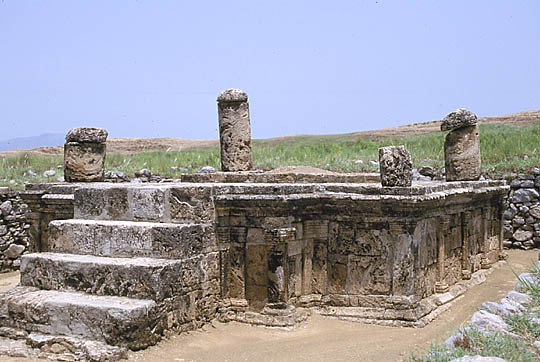
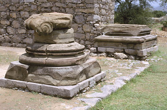
Jain Shrine along the streets of Sirkap (2nd century BC to 2nd century AD)
Just a few dozen meters from the Shrine of the Double-Headed Eagle sits the Jain Stupa, a relic of the Sirkap city period. The shrine is badly ruined. Nothing of the superstructure survives. The persepolitan columns with lion ornamentation that sit on the four corners were brought here from the ruins of the courtyard.
Jandial Temple (2nd century B.C. to 2nd century AD) greatly resembles ancient Greek temples
Located in Jandial, about a mile from the north gate of Sirkap, are the remains of Jandial temple, one of the most unique buildings in Central Asia. Probably intended as a Zoroastrian temple, the building closely follows the paradigm of the temples of classical Greece, consisting of a central shrine with four Ionic columns supporting a porch. The main shrine is rectangular in plan, but instead of the usual colonnade found in Greek temples, the wall is solid masonry with pierced window openings. Behind the main shrine is a set of stairs that leads to a platform where a Parthian fire Sanctuary probably existed in the 1st century BC. The Greek influence is not surprising, as Hellenic culture spread through the area in the wake of Alexander's conquest in the first few centuries BC.
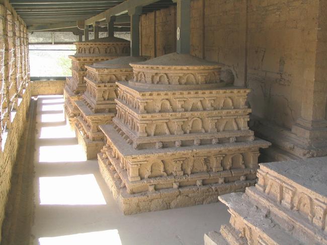
The Mohra Moradu Monastery flourished as a beacon of knowledge from 3rd to 5th centuries AD and is located in a small valley between Sirkap and Jaulian. It has been savagely damaged by treasure-hunters who split apart the main stupa hoping to find gold inside. The lower portions of the stupa were protected, however, as earth covered most of the site before excavation began under the auspices of John Marshall earlier in the 20th century. A Buddhist shrine, the monastery was once a place of meditation in the rural areas outside of busy Sirkap. The stupa is famous for the many bas-reliefs of Buddha that adorn its base. The monastic cells around the stupa are badly damaged, but yielded such treasures as the stone stupas.
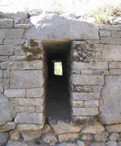
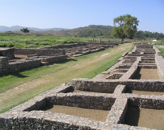
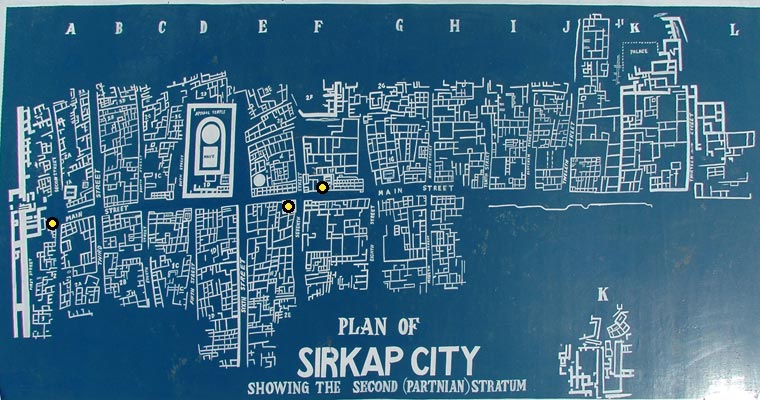
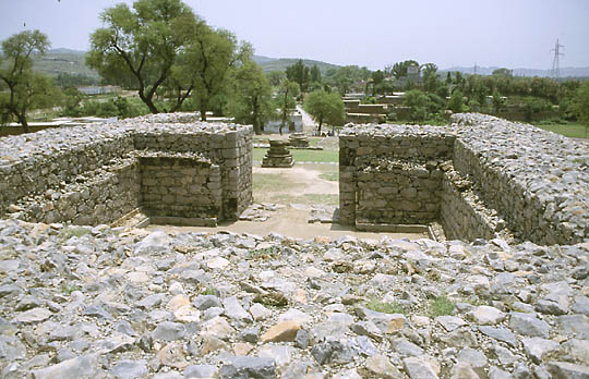
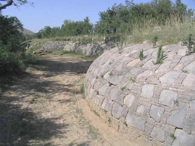
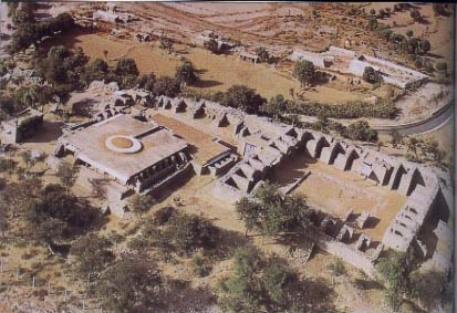
Left to Right: Sirkap Bastions - Main Road - Plan of Sirkap City
After the Bhir Mound site was abandoned, Sirkap became the major city of Taxila in the 2nd century B.C. The city is heavily influenced by Greek city planning principles introduced to the area after Alexander's conquest in the 3rd century B.C. Now a ruin, the city once boasted a 6-meter thick, 5 kilometer long defensive wall made of course rubble. As in ancient Greek cities, there was a fortified "acropolis" or high ground within the defense perimeter. The streets of the cities were more regular than those at Bhir, and the houses were mostly made of coursed stone. There were temples, houses, shrines, and stupas all along the main north-south street.
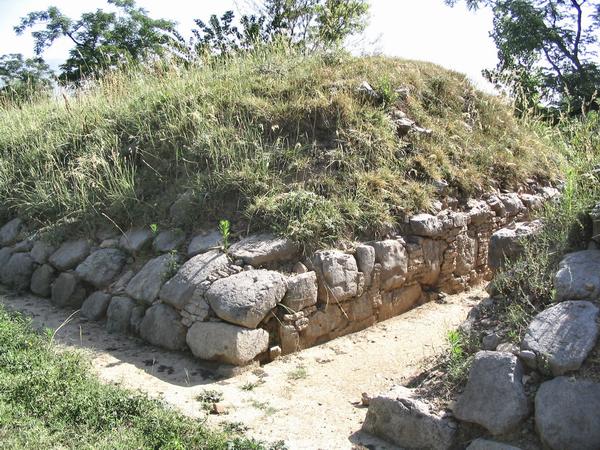
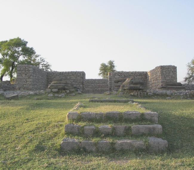
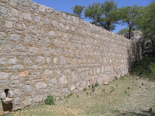
Left to Right: Sirkap Stupa - Walls
On the east side of the street are several notable structures, such as the Shrine of the Double-Headed Eagle, the Apsidal Temple, and a palace at the south end of the streets. Next to the Apsidal Temple is a small stupa which was probably constructed by a private owner. In the house near the stupa was found several items such as a bronze statue of the Egyptian child-god Harocrates, a silver Dionysus head, and gold and silver jewelry. Sirkap flourished under several different regimes, beginning with the Greeks, then the Scythians, Parthians, and finally the Kushanas. The city lost its importance after King Kanishka of the Kushan dynasty founded another city at nearby Sirsukh. A cut through the fortification wall, which is almost 5 kilometers long and nowhere less than 6 meters thick. It circumvents an irregular square of 1350 x 1000 meters. The inner part of this citadel was not really investigated by archaeologists. It is low-lying and abundantly irrigated land, where ruins are buried inaccessibly deep. Sirsukh was left when the White Huns invaded the Punjab at the end of the fifth century.
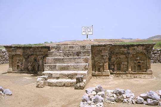
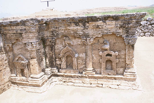
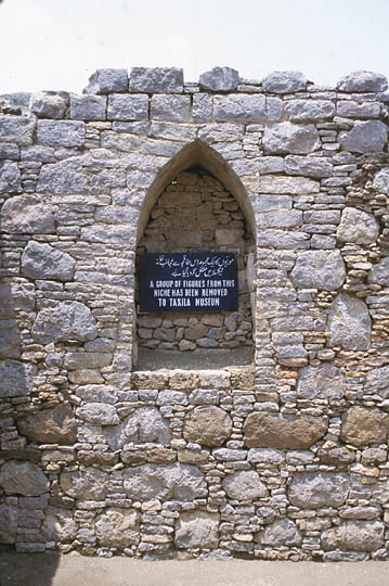
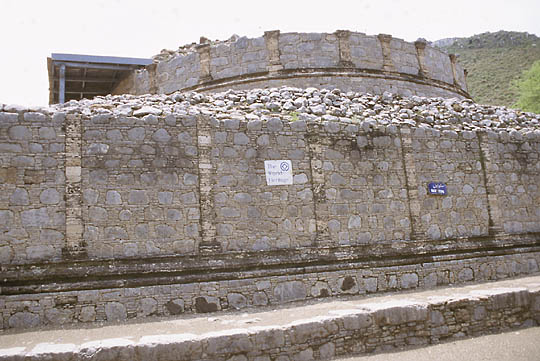
Double-Headed Eagle Shrine (2nd century B.C. to 2nd century A.D.)
Remains of a shrine that shows heavy Bactrian Greek influence
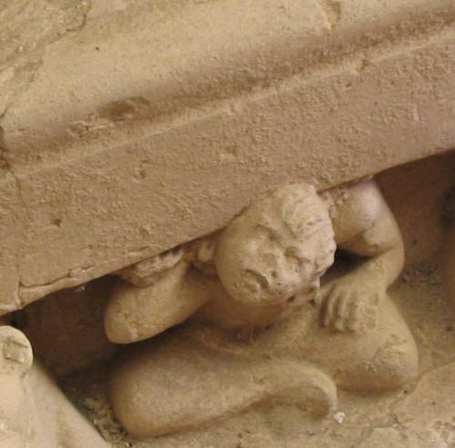
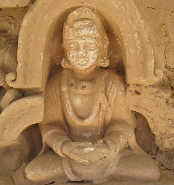
Along the main street of Sirkap, the ancient city, sits the Double-Headed Eagle Shrine. Its original name is lost, but is now referred to as the double-Headed Eagle Shrine because of the bird bas-relief that adorns the arch (images two and three). Of Scythian origin, the double-headed bird motif is common in Eurasia, appearing in Byzantine and European armor crests as well. The shrine reflects Bactrian Greek influences brought to the area by Alexander's army, who unwittingly left a Hellenic cultural imprint. The columns decorating the sides of the shrine are clearly Corinthian and the pediment is classically Greek. This is not to say that the shrine is entirely Greek - far from it. There are also Indian influences which can be visibly observed from various ornamented Indian architectural styles.
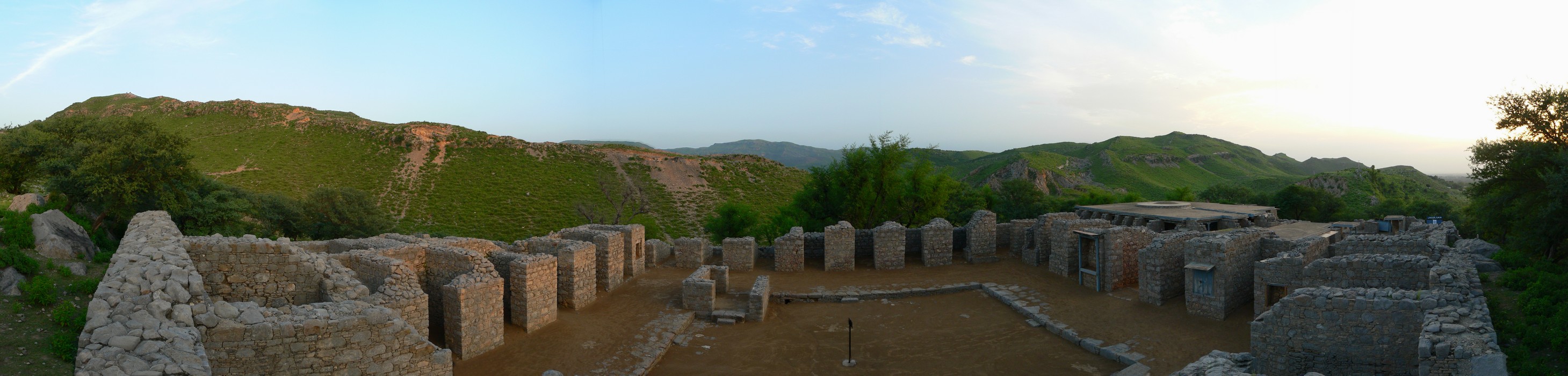
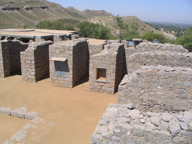
Far away from the noise of the city of Taxila-Sirsukh, the monastery and university of Jaulian was situated on a mountain top that rises some 100 meters above the surrounding country - on a cool and dustless site. This picture shows part of the central court. In front of the cells must have been a verandah. The entrance, leading to the central court. Like other monasteries in Gandara and the Punjab, the cells surrounded a rectangular central court with a bathroom (jantâghara), an assembly hall (upasthâna-sâlâ), a store-room (koshthaka), a kitchen (agni-sâlâ), a refectory (upâhâra-sâlâ), and a latrine (varchah-kutî). There was no well at Jaulian, but there were sources at the foot of the hill. Jaulian does not really differ from the settlement at Mohra Moradu, which is just over a kilometer away. The settlement had been restored briefly before it was abandoned, after the invasion of the White Huns at the end of the fifth century. Therefore, the decorations are better preserved than those at Mohra Moradu, but unfortunately, they are of a poorer quality. This picture shows the outer wall of the building - well preserved.
Left to Right: Julian Altar - Buddha - Main Stupa (votive stupas)
Left to Right: Julian Monasteries - Wall - Statue of Healing Buddha (Still revered by Buddhists to posses power of healing)
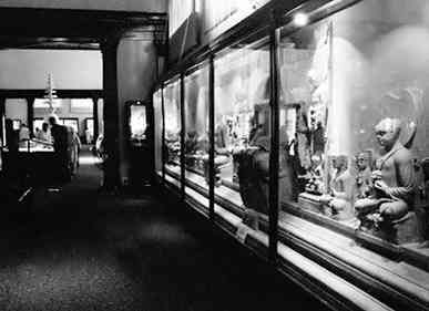
Some of thee rare relic have been preserved in the Taxila Museum which should not be missed while taking a tour of the sites.
|
| HOME PAGE | ARCHAEOLOGICAL TREASURE OF PAKISTAN |
This page was created on
16 October 2006
|