Dera Ismail Khan
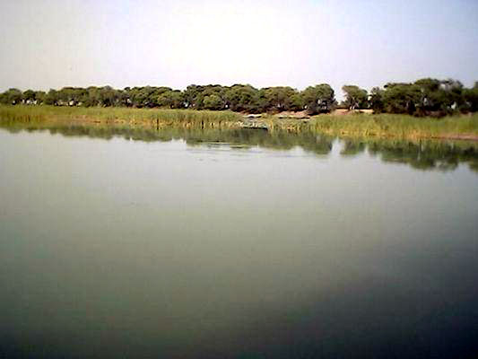
Indus River flowing by D I Khan
Dera Ismail Khan is yet another city of the NWFP province of Pakistan, located west bank of the Indus River, some 120 miles north west of the ancient city of Multan. Dera Ismail Khan or D I Khan (as very commonly referred to) was founded towards the end of the fifteenth century by Ismail Khan, a son of the Baloch adventurer Malik Sohrab. The original town was swept away by a flood in 1823, and the present town stands four miles back from the permanent channel of the river. The descendants of Malik Sohrab, who settled there after migrating from Iraq, ruled the city for 300 years. The city situates itself on a level plain, with a slight fall to the river. It is surrounded by a thin mud wall, with nine gates.
Like all tribal towns and cities of the NWFP, the D I Khan also came to prominence during the British occupation of India. During British rule the town contained two bazaars, the Hindu and Muslim population living in separate quarters. The cantonment lies south-east of the town while the civil lines are to the south. The Dera - jat (plural of dera) Brigade had its winter headquarters at D I Khan, and the garrison consisted of a mountain battery, a regiment of Native cavalry, and three regiments of Native infantry. The municipality was constituted in 1867. In those days, the local trade of D I Khan was of second-rate importance, but some foreign traffic with Khorasan passed through it. Powinda caravans of Afghan merchants traversed the town twice a year on their road to and from India, through Gomal route. The chief imports were English and native piece-goods, hides, salt, and fancy wares, and the exports, grain and wood. The then town had a civil hospital and the first civil surgeon of the civil hospital was Dr.Bhagwan Das Dhamija and Bharati Sabha. The trade flourished after roads were built by Military Engineering Services in the 30's.
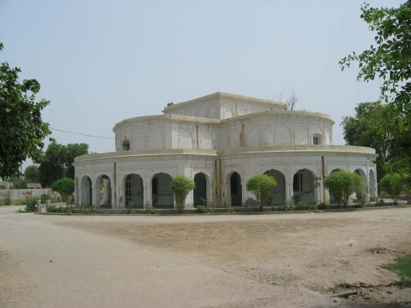
A British era building
D I Khan is famous for its lacquered woodwork, glass and ivory ware, mats, and sarongs. Newer industries include soap factories and textile, rice, flour, and oil mills. One of the most famous products of this district is the "Dhakki Date", which is exported to Middle East, United States, and Europe. This date is grown in the nearby village of Dhakki. There are also coal mines in the nearby village Saidu Wali on the edge of CRBC Canal.
Presently, the city is connected to Bannu via the highway, which further connects it to the provincial capital of Peshawar via Kohat and Darra Adam Khail. Another road connects D I Khan to Mianwali through Chashma Barrage. The third major road connects it to Bhakkar in Punjab, situated on the eastern bank of Indus River. The bridge on the Indus River was constructed in early 1980s, before which the approach to Bhakkar was made through a boat bridge. The city has telephone, telegraph, and internet facilities- although telegraph has recently been abandoned in line with the government policy of transitioning away from telegraph communications throughout the country.
The city has not very worthwhile tourist attractions since all old buildings had been damaged in the 1823 floods. The remains of the original wall is still visible around the old city. A popular tourist destination is a pre-Islamic fort called Bilot, 30 miles from the city on D I Khan- Chashma highway. These ruins are situated on a hill. A Sikh shrine is located in the Chota Bazaar of city as Guru Nanak visited this place during his fourth itinerary. At the site where he stayed a dharamsala was built by his devotees. It is a large building, its main gate opens in the Chota Bazaar. Inside this door there is a double storey square building. There are residential rooms around this building for pilgrims. Presently the Government Higher Secondary School No. 3 is housed in this building.
As of now, D I Khan is not very developed and most of the people live below poverty line. Despite being situated on the bank of Indus River, no worthwhile effort has been made to make use of the Indus water for its development. There is very little agriculture and virtually no industries. Mostly people work on small fields to earn crops for their families. Many people are serving in Army. The city is seat of Gomal University founded in 1974.
![]()
Related Links | Video Clip (YouTube) | Aquatic Plants of District Dera Ismail Khan, Pakistan | D I Khan Pictures (You Tubde |
|
| HOME PAGE | MORE CITIES | Copyright©JalalsPages - 2009 |