MEET ME IN THE MOUNTAINS
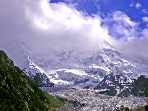
[The spectacular view of Karakoram (56km long Batura Glacier above, with Passu Cones just on near right) courtesy www.leelau.net]
Pakistan is a blessed country to have three of the major mountain ranges in the world, the Himalayas, the
Karakoram and the Hindu Kush. Thirteen of the world's 30 tallest peaks are in Pakistan (of eleven over 8,000 meters high mountains tops,
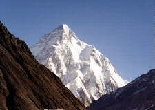
five are located in Pakistan). K-2, the world's biggest pyramid and second to Mt
Everest and the Trango Towers are just the two examples of richness of
our mountain treasure. The glory and the beauty of the mountain world all concentrated in here. Those who love natural beauty in awesome silence, should meet in our mountains and witness the wonders of the world in
awesome silence. This site reveals the grandeur and glory of these mountain ranges and their pinnacles. Read and be spellbound!!!
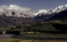
En route to Khunjrab, before Gilgit, there is a road sign inviting the attention of the tourists to stop and see the the Hindu Kush (left) mountains converge with the Karakoram Range (centre), a part of the Himalayan mountain system (right). (Photo courtesy The Sloths - Flickr)
Mountain Ranges
Aerial view of K2, Baltoro glacier , G4, G2 and G1 (Video Courtesy: SULEMANI / TARIQ " jeep rally 2009 26th February )
The Karakoram:
 The
The
Karakoram peaks have nicknames that evoke fear and passion: "Savage Mountain" for K2, "Killer Mountain" for Nanga Parbat (8,125 meters) "Shining Wall" for Gasherbrum IV (7,929 meters) and "Bride's Peak" for Chogolisa (7,665 meters), which is the feminine analogue for Chogori, K2, its neighbour and wife in local folklore.
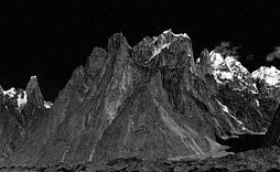
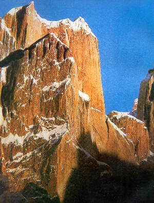
The Trango Tower (below left and centre) is the highest rock pinnacle of the world rising to 6,257 meters/ 20,857 feet. Rugged, un-scalable and challenging. Many climbers have returned unsuccessful owing to its almost vertical climb. Read Exclusive section on the Trangos.
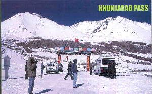
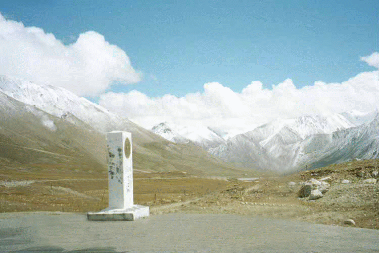
Khunjrab Top
The Hindu Kush:
Compared to the Karakorams and the Himalayas, is a smaller range spread over an
area of 400 x 250 miles. It has several peaks over 25,000 feet and the highest
is Trichmir 7690 m (25,230 ft)- also called Queen of Chitral. The range extends generally in a south-westerly direction for more than 800 km (500 mi), from the plateau region
of the Pamirs on the borders of Afghanistan; North-West Frontier Province,
Pakistan; and Tajikistan. These mountains, consisting of granites and schist,
or crystalline rocks, were probably uplifted in the Tertiary period. The system
is in part marked by over thrust of Cretaceous lime stones on Cenozoic shale and
clays.
In the first 160-km (about 100 mi) section west of the Pamirs, the Hindu Kush
extends southward. In this section the system has a comparatively wide, plateau
like summit, dotted with small glacial lakes, and passes ranging in height from
3810 to 5335 Metres (about 12,500 to 17,500 ft) above sea level. The system then
turns to the southwest and gains in elevation, and the plateau summit breaks
into peaks. Many other peaks in this section rise more than 6096 m (20,000 ft).
The Hindu Kush is also the source of many rivers; the most notable are the Kabul
and Konar Rivers and several tributaries of the Indus River on the southern
slopes.
The Suleiman Range:
The mountain range in central Pakistan, extends about 400 km (about 250 miles) in a northern and southern direction and generally parallel to the Indus River. The average elevation is about 1,520 Metres (about 5000 ft). The highest points are the twin peaks of Kaisargarh (3,441 Metres /11,289 ft) and Takht-i-Sulaiman (3,379 Metres/11,085 ft). The latter peak takes its name ("throne of Solomon") from a throne-shaped hollow in the solid rock of the southern slope. The twin peaks of the range 3,443 Metres and 3,379 Metres high, at the northern end of the range, are the highest points.
Khyber Pass
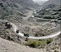
The Mountain Passes: Many mountain passes connect Pakistan with Afghanistan and China which have been and still being used for trade. Those bordering Afghanistan include the Khyber, Bolan, Khojak, Kurram, Tochi, and Gomal passes. At 1,072 m (3,517 ft) Khyber Pass is the most well-known and well-travelled. It links Peshawar in Pakistan with Jalalabad in Afghanistan. The Bolan Pass links Quetta in Balochistan Province with Kandahar in Afghanistan; it also serves as a vital link within Pakistan between Sind and Balochistan provinces. Beside trade, the Khyber and Bolan passes were also used by many invaders to enter India from Central Asia, including the armies of Alexander the Great. Karakoram Pass, on the border with China had been for centuries was part of the trading routes known as the Silk Road, which linked China and other parts of Asia with Europe.
Famous Pinnacles of Pakistan
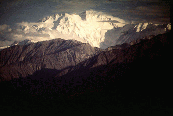
The Nanga Parbat, meaning the Naked Mountain in native language, a 8,125 Metres or 26,657 feet tall Himalayan peak. The summit is shaped like a reclining women, as remarked by some imaginative mountain and beauty lover. If flying to Skardu, one can see the Nanga from the right window of the aircraft. One can feel the grandeur of the height when flying almost to the level of its peak. Read More about Nanga Parbat.
Nanga Parbat, located at the western end of the Himalayas, was first conquered by Herman Buhl, of Germany, in 1953 after 31 people died attempting it. Since then more have died on its slopes and the toll is now 47, far fewer than Everest, but fewer people try to climb Nanga Parbat, which is regarded as technically one of the most difficult mountains to climb.
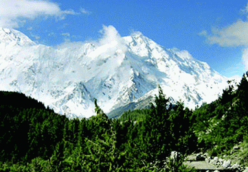
Rakaposhi
Dominating the Gilgit Valley is the massive bulk of famous climbing mountain, Rakaposhi, the summit of which is 25,550 feet is perennially snow clad. The peak resembles a huge and jagged shark's tooth. Tourists go to a place near Hunza, where one can see the mighty Rakaposhi rising from ground level to its pinnacle. A scene never to be forgotten. (Photo courtesy Khalid Bukhari) |
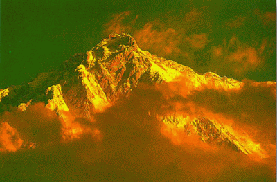
Tirchmir
The Hindu Kush mountain range in central Asia extends for 1,000 km (600 mi) in
parts of Afghanistan, Pakistan, and Tajikistan. With about two dozen peaks
surpassing 7,000 m (23,000 ft), the range reaches its highest point in
Pakistan’s highlands, where the peak known as Tirchmir rises 7,690 m (25,230 ft)
above sea level (ranks 33rd in the world of highest pinnacles). It was first
climbed in 1950 by a Norwegian expedition which was lead by Arne Naess. the
famous Norwegian philosopher, other expedition members were P. Kvern berg and H.
Berg. |
|
This page was created on 1 January 2005 / Copyright©JalalsPages - 2005 - 2012 |